")
…
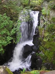
Waterfall Season In Cook County
…
221 West First Street
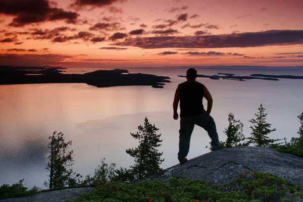
In a league of its own, the 154-mile North Shore Scenic Drive is Minnesota’s only designated “All-American Road.” The route parallels the inland coast of the world’s largest freshwater lake, Lake Superior, bisecting ancient rock formations and thousands of acres of forests rising…

4051 Highway 61
Eight miles up the road from Grand Marais, at Judge C.R. Magney State Park you’ll meet the Brule River. Best known for the Devil’s Kettle waterfall where the river splits and half the river enters a cauldron, the Devil’s Kettle, and disappears to places unknown…. Enter Judge…

7232 Highway 61
A short gradual climb along the river will bring you to the spur trail of the Superior Hiking Trail to the base of the waterfall. Park at Caribou State Wayside rest; off of Highway 61

3650 W. Highway 61
A breathtaking series of large cascading waterfalls; this location includes parking and a walking path, which makes hiking along multiple waterfalls possible. The Cascade River flows from one ledge after another for a total drop of 900 feet during the last three miles to Lake…

Highway 61
Best falls seen right from the highway at the wayside rest in Schroeder. Just eight miles north of the county line, you will find easy access and parking. Bring a raincoat. The view from the bridge on scenic Highway 61 is one of the best, and the spray might ruin your hair.

Highway 61
The Devil Track River is located 3.5 miles northeast of Grand Marais on Highway 61. Follow the Superior Hiking Trail on County Rd. 58 (Lindscog Rd.) for a view of the Devil Track River Gorge. In the winter, the falls are more easily accessible by snowshoe with caution.

Highway 61
This waterfall can be found just two miles west of Grand Marais along Highway 61. The main waterfall is on the lakeshore side of Highway 61 and plunges into Lake Superior. Follow the Gitchi-Gami State Trail to the bridge that offers incredible views of the falls.

5059 Highway 61
The Flute Reed River empties into Lake Superior at Hovland, 18 miles northeast of Grand Marais, MN. It is designated a trout stream by the state. The river is 9.2 miles long, with an unnamed waterfall on the lakeside of Highway 61.

Saganaga Lake
The Granite River is a favorite route for many people who visit the Gunflint Trail. The river flows north from Gunflint Lake along the border of Minnesota and Canada up to Saganaga Lake. The river is approximately 25 miles long with around 13 portages around rapids and small…

Highway 61
Just 12.7 miles east of Grand Marais, the Kadunce has easy access, up-top viewing, with a hike on the Superior Hiking Trail. Feeling adventurous? Hike up the shallow river for a different vantage point. Parking is available in the lot off of Highway 61.

6355 W Highway 61
Newly reconstructed trail from Highway 61 will bring you along the river for a canyon view. Legend has it that the river was created when Paul Bunyan shed tears while cutting the wild onions that grew in the woods nearby. Park at the Ray Berglund Memorial Wayside rest right off…

9393 Highway 61
In Grand Portage State Park at 120’ the High Falls is the tallest waterfall in the state of Minnesota. Handicap accessible trail is about 1 mile long. During peak waterfall season, find a nearly permanent rainbow at the base of the High Falls. Parking is available in the Grand…

Ski Hill Road
Hike inland to roaring fall, cascades and canyons. You’ll find multiple waterfalls and rapids that are easily accessible from multiple locations. Upper Falls above Lutsen Mountains Ski Hill – park at the end of Ski Hill Road at the start of the connector trail for the…
Duncan & Rose Lake
Between Duncan and Rose Lake in the Central Gunflint Trail region. Must use a canoe to reach this area.

7620 West Highway 61
Temperance River State Park there is a short hiking trail loop that will bring you around the falls. Deep narrow river gorge with about 10-15 drops. According to the state parks section of the Minnesota Department of Natural Resources website.
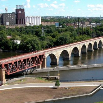
ICYMI
ICYMI: Omforme Interior Design: The Foley Mansion Restoration – St. Cloud, MN